Shadow Lake Day Hike
Reds Meadow - Ansel Adams Wilderness
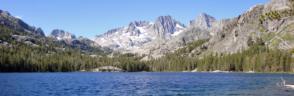
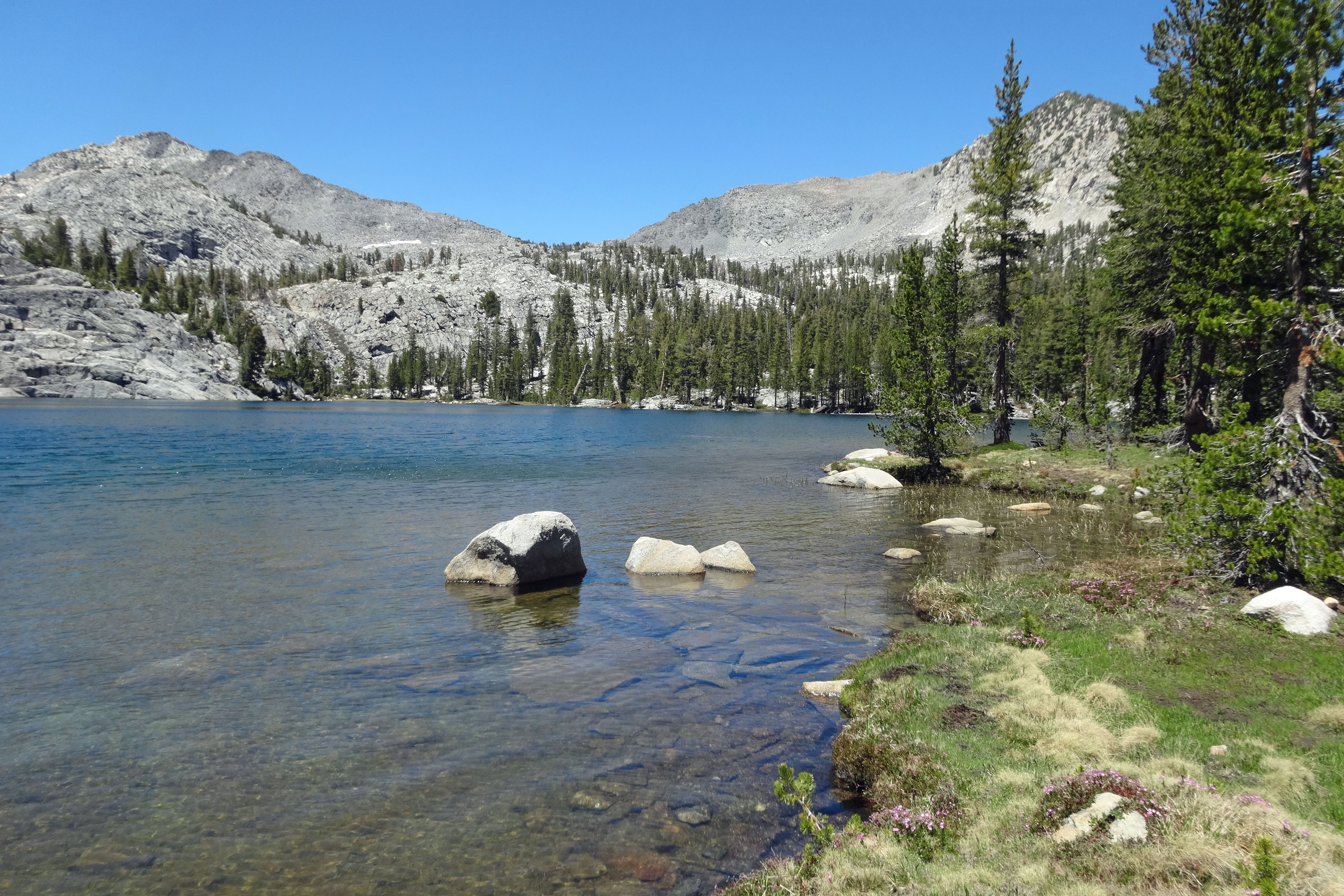
Spectacular Shadow Lake is well worth a day-long outing from Agnew Meadows, part of Reda Meadow, west of Mammoth Lakes. Hikers are rewarded with magnificent views of the lake with the jagged peaks of the Ritter Range towering just beyond. The John Muir Trail passes the western end of the lake, but no camping is permitted around its shores. The 3.8-mile hike from Agnew Meadow climbs 1,552 feet, most of it in the last 2 miles.
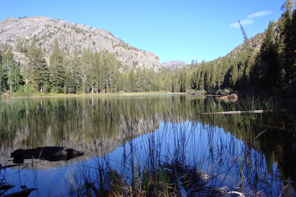
Olaine Lake
Shadow Lake Trailhead
Strenuous
7.6 miles
1,552 feet
Reds Meadow
The Agnew Meadows trailhead for Shadow Lake is along a side road leading off the north end of the main road into Reds Meadow. During the summer when the shuttle bus is in operation, hikers are dropped at the turnoff to Agnew Meadows (shuttle bus stop #1), adding 0.4 miles to the hike in each direction.
In spring, early summer, and in the fall, when the shuttle is not in operation, hikers can drive to the trailhead. Restrooms and water are available there.
Reds Meadow Shuttle Bus Information
During the summer, most visitors to the Reds Meadow/Devils Postpile area must use the shuttle bus from near Mammoth Mountain Ski Area's Adventure Center. Fees are $15 for adults, $7 for children ages 3 to 12, and children 2 and younger are free. The bus makes a number of stops around Reds Meadow. Once visitors are in Reds Meadow, the shuttle is free for trips among the various stops.
Read details of dates and times at
Reds Meadow/Devils Postpile Shuttle Information.
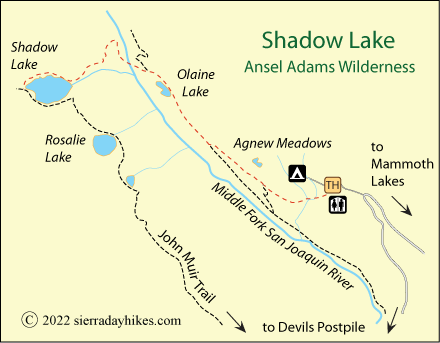
Shadow Lake Trail
From an Agnew Meadows trailhead at an elevation of 8,300 feet, hikers pass a number of connecting trails in the first 1½ miles as they head northwest, gradually descending along a ridge above the Middle Fork San Joaquin River. At 2.2 miles sits little Olaine Lake. Beyond the lake, stay to the left at a well-marked junction as the Shadow Lake trail bends toward the river, crossing a bridge after 2.8 miles.
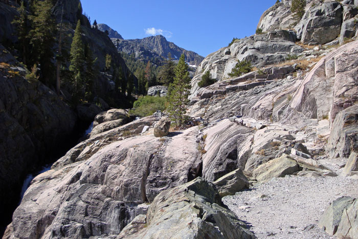
Once across the bridge, the climb begins as the trail heads up the side of the canyon toward Shadow Lake. Shade is sparse here. In places the trail has been carved out of the granite mountainside. Soon Shadow Lake emerges in a beautiful panorama of sparkling water and rugged granite peaks. Great picnic spots are found all along its shore. The lake rests at an elevation of 8,733 feet.
Shadow Lake Trail
Things to Know
- Carry plenty of water for the steep final miles up to the lake.
- Leashed pets are allowed on the trails, but dogs must wear a muzzle when riding the shuttle bus.
- In spring and fall when the shuttle bus is not operating, visitors may drive their vehicles into Reds Meadow. They still must pay an entrance fee.
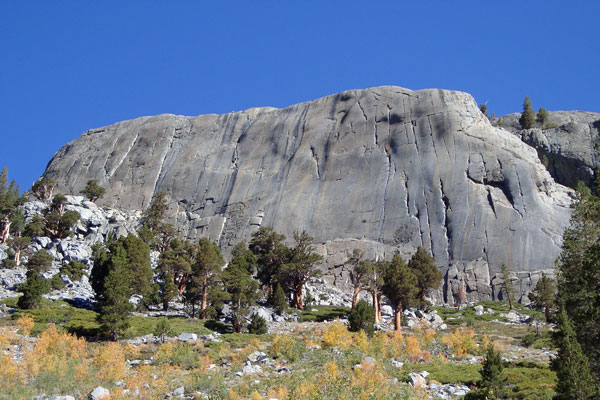
Glacier Polished Granite Overlooking Shadow Lake
Nearby Sierra Day Hikes
- Crystal Lake - a dazzlingly beautiful lake
- Minaret Falls - a short hike to pretty cascade
- Rainbow Falls - a beautiful 100-foot tall falls in Devils Postpile
Other Nearby Trails
The Wildflower Trail is a short loop next to shuttle bus stop #1, at the entrance to Agnew Meadows.
The River Trail leads off the Shadow Lake trail and continues downstream, soon becoming the Pacific Crest Trail. It is about 6 miles from Agnew Meadows to the Devils Postpile Ranger Station via the River Trail.