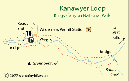
Kanawyer Loop Day Hike
Kings Canyon National Park
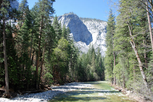
The Kanawyer Loop begins at Roads End in Cedar Grove and follows the South Fork of the Kings River upstream to the Bubbs Creek Bridge, crosses, and returns along the other side of the river. This scenic tour offers a sample of the Kings Canyon wilderness with views of soaring cliffs and sculpted granite peaks, and the majestic Kings River.
South Fork Kings River
Kanawyer Loop Trailhead
Moderate
5 miles
151 feet
Kings Cnyn.
The Kanawyer Loop trailhead is at Roads End, 5½ miles east of Cedar Grove Village and 5,000 feet in elevation. To the right is parking for day use while around to the north is a large lot for overnight backpackers into the Kings Canyon wilderness. Roads End is the starting point for many popular backpacking trips, especially the Rae Lakes Loop. Roads End has restrooms available. Food and scented items should be stored in provided bear boxes while you are away from your vehicle.
Kanawyer Loop Trail
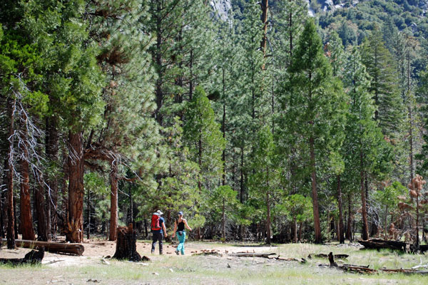
Begin at Roads End where the trail passes the permit station and signs point to Mist Falls and Paradise Valley. No permits are required for day hikes, but the rangers at the station can provide current information about trail conditions. After crossing Copper Creek, the trail passes into a long sandy stretch among scattered trees. Views of the surrounding canyon walls soon open up.
Kanawyer Loop Trail
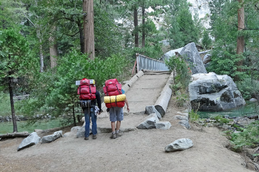
At about 1½ miles, the trail enters a much different environment with dense trees and clusters of ferns on either side of the trail. Sounds of the nearby river soon follow. At mile 2 is a trail junction, to the left Mist Falls and Paradise Valley, to the right Bubbs Creek. Turn right and cross the sturdy bridge over the South Fork of the Kings River. Plan to spend time there enjoying the views of the river and canyon.
Once across the bridge, soon turn right on a trail leading back down the south side of the canyon. This is a more challenging section of trail with some rough sections through granite and creek crossings that can be difficult in spring and early summer. Those who would prefer an easier trail can double back the way they came.
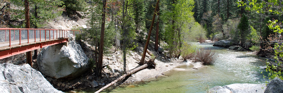
Along the south side of the river, the trail passes into open areas offering great views of the canyon and often hugs the river providing good access for fishing. The final turn is onto Red Bridge (shown in masthead above) back across the river. Not far beyond is the Road's End parking area.
Things to Know
- Wilderness permits are not needed for day hikes on wilderness trails.
- Pets and mountain bikes are not allowed on any park trails.
- Restrooms and drinking water are available at the trailhead.
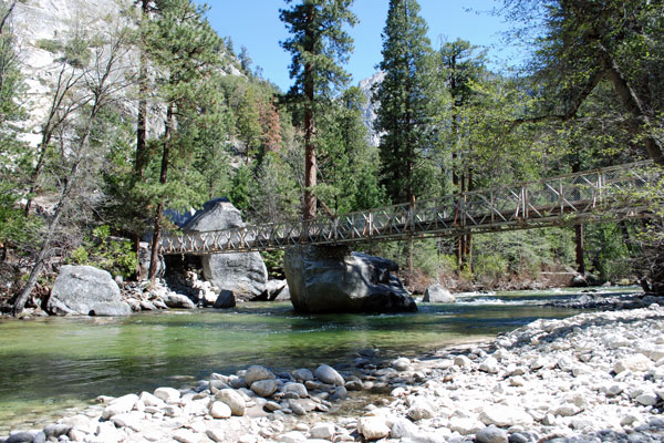
Bridge Spanning Kings River near Bubbs Creek
Nearby Sierra Day Hikes
- Mist Falls - rewarding wilderness hike
- Roaring River Falls - short hike, pretty falls
- Zumwalt Meadow - a pleasant loop trail at Road's End
Other Nearby Trails
The River Trail connects the Kanawyer Loop Trail with the Zumwalt Meadow Trail on the south side of the river just before the lower bridge crossing.