Mist Falls Day Hike
Kings Canyon National Park
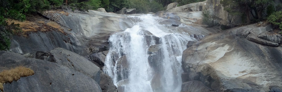
Mist Falls is one of the largest and prettiest falls in Kings Canyon National Park. The 4.6-mile (one way) Mist Falls day hike is best done as a full day outing, heading out in the cool of the morning and enjoying a picnic lunch spread on the rocks near the base of the falls. However, in the spring and early summer the air around the base of the falls is thick with mist, sending picnickers a little farther downstream.
Mist Falls in Spring
Mist Falls Trailhead
Strenuous
9.2 miles
800 feet
Kings Cnyn.
The Mist Falls trailhead is at Roads End, 5½ miles east of Cedar Grove Village at 5,000 feet in elevation. To the right is parking for day use while around to the north is a large lot for overnight backpackers into the Kings Canyon wilderness. Roads End is the starting point for many popular backpacking trips, especially the Rae Lakes Loop. Store any extra food and scented items in the nearby bear boxes. Roads End has restrooms and water.
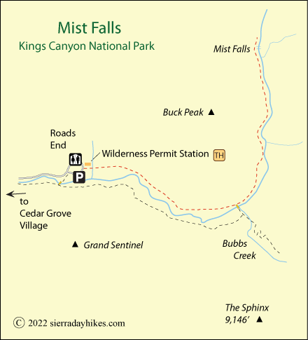
Mist Falls Trail
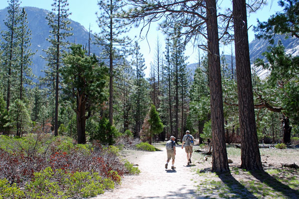
Start at Roads End east of Cedar Grove. The trail begins in front of the permit station where signs point to Mist Falls and Paradise Valley. No permits are required for day hikes, but the rangers at the station can provide current information about trail conditions. Beyond the Copper Creek bridge, the trail passes into a long sandy stretch among scattered trees and open meadows.
Then near 1½ miles the trail transitions to more densely forested terrain with thick clusters of ferns abounding. At mile 2 is a trail junction, to the left Mist Falls and Paradise Valley, to the right Bubbs Creek. Even though your route is up to the left, a short diversion to the right onto the bridge across the South Fork Kings River provides nice views of the river and canyon.
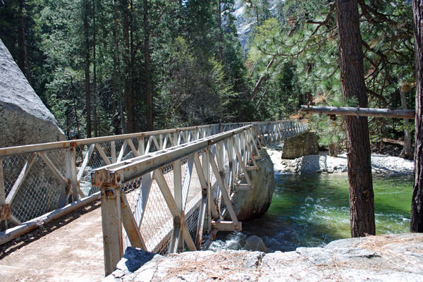
Bridge over South Fork Kings River near Bubbs Creek
Double back to the Mist Falls Trail and enjoy another mile with mostly gentle grade. Then abruptly the trail begins to climb, working its way upward through trees and rocks. Take moments to look back down the canyon at the spectacular Sphinx jutting out from its granite base.
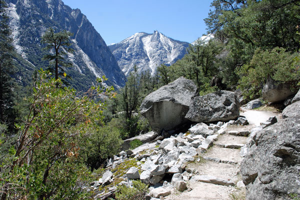
The Sphinx from the Mist Falls Trail
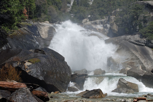
Once in sight of the falls, take a use trail off and down to the area below the falls. At times of high runoff, mist boils off the falls and fills the air. While you could follow the main trail up to the top of the falls, venturing onto the rocks near the rushing water is extremely dangerous and vigorously discouraged.
Things to Know
- Gnats can sometimes be annoying along the trail in late summer.
- Wilderness permits are not needed for day hikes on wilderness trails.
- Pets and mountain bikes are not allowed on any park trails.
- Restrooms and water are available at the trailhead.
Setting out for Mist Falls
Nearby Sierra Day Hikes
- Kanawyer Loop - hike up one side of the Kings River and down the other
- Roaring River Falls - short hike, pretty falls
- Zumwalt Meadow - a pleasant loop trail across a bridge and around a scenic meadow
Other Nearby Trails
The River Trail leads off the Kanawyer Loop Trail after crossing the bridge southwest of Roads End. The River Trail leads to the Zumwalt Meadow Trail and eventually the Roaring River Falls Trail.