Panoramic Point Day Hike
Grant Grove - Kings Canyon National Park
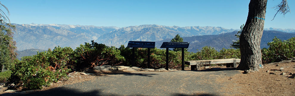
An easy ¼-mile walk up a paved trail leads to Panoramic Point and neighboring Park Ridge Viewpoint (shown above), both overlooking the spectacular Kings River Canyon. In the distance stand the magnificent peaks of the Monarch Divide, while far below flows the mighty Kings River. In places the Kings River Canyon exceeds 8,000 feet in depth, greater than the Grand Canyon.
Panoramic Point
Panoramic Point Trailhead
Easy
½-mile
100 feet
Kings Cnyn.
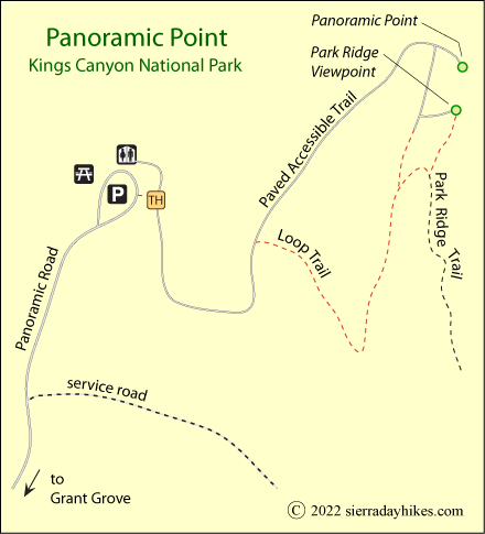
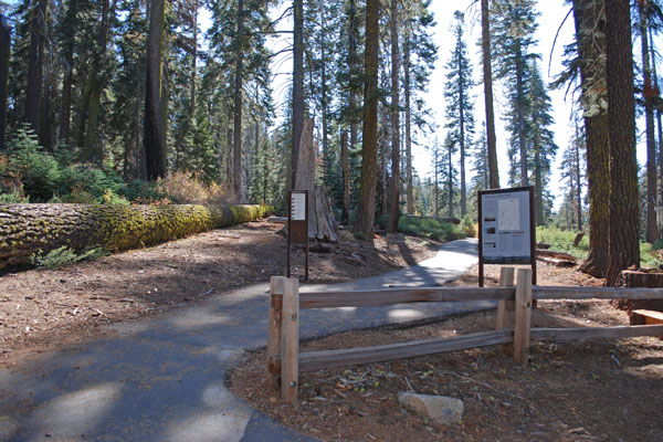
The Panoramic Point trailhead is 2 miles from the heart of Grant Grove, traveling first on Grant Grove Drive past the Visitor Center and then on Panoramic Road. At the parking lot visitors find accessible restrooms and picnic tables.
Panoramic Point Trailhead
Panoramic Point Trails
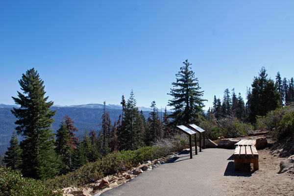
A short distance from the parking lot the trail separates into the Accessible Trail and the Loop Trail. The Accessible Trail is paved and offers a gradual slope, making it wheelchair accessible with assistance. The dirt trail loops up the hillside and joins the accessible trail at the top. Either way is about 100 feet in elevation gain. Panorama Point is at 7,500 feet.
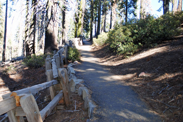
Panoramic Point Accessible Trail
Two Viewpoints
The northern viewpoint is the official Panoramic Point while the other is known as Park Ridge Viewpoint. The final few yards to Panoramic Point are somewhat steeper and more uneven than the approach to Park Ridge Viewpoint. Both trails are paved and offer similar views and informational signs.
Panoramic Point displays informational signs and illustrations depicting the mountain skyline with its major peaks, including 10,051-foot Spanish Mountain, the Obelisk, Mount McGee, and more distant Mount Goddard, Kettle Dome, North Palisade, and Eagle Peak. In the foreground below lies popular Hume Lake.
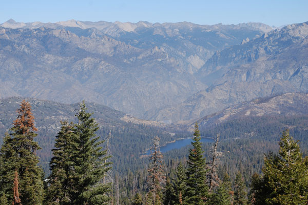
Hume Lake
Things to Know
- Pets are not allowed on any park trails.
- Water is not available at the trailhead or along the trail.
- Restrooms are available at the trailhead.
Nearby Sierra Day Hikes
- Buena Vista - 1-mile hike to summit and great views
- General Grant Tree - beautiful stroll among Sequoias
Other Nearby Trails
Park Ridge Trail leads south from Panoramic Point 2½ miles up the ridge to Park Ridge Fire Lookout Tower.