Mount Rose Day Hike
North Lake Tahoe, Nevada
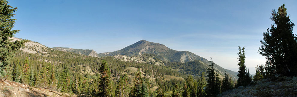
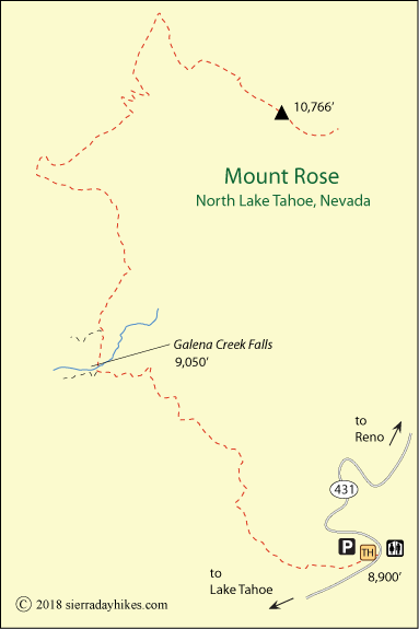
At 10,776 feet, Mount Rose is the most prominent peak around North Lake Tahoe. From an 8,900-foot trailhead, hikers soon gain magnificent views of Tahoe Meadows and Lake Tahoe. A beautiful waterfall greets hikers halfway to the summit and at the top, panoramic views appear, spanning Reno, the Tahoe Basin, and Boca Reservoir. Perhaps if the air is especially clear, views extend all the way to Mount Lassen.
The first half of the 5-mile hike to the summit is nearly level, with only 150 feet of elevation gain. That makes the waterfall on Galena Creek, 2½ miles from the trailhead, a popular destination for those who don't want to continue on the rigorous second half of the route to the summit.
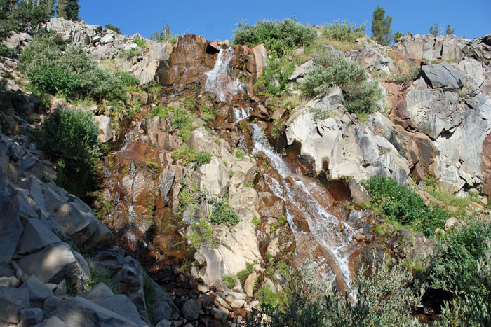
Galena Creek Falls
Mount Rose Trailhead
The Mount Rose trailhead is a parking plaza at Mount Rose Summit along Highway 431, 10 miles north of Incline Village. Visitors find restrooms at the trailhead along with information panels and maps.
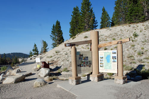
Mount Rose Trailhead
Mount Rose Trail
Strenuous
10.6 miles
1,876 feet
North Tahoe
From a trailhead at Mount Rose Summit on Highway 431, a wide trail climbs though a conifer forest and then begins a gradual descent. Views of Mount Rose, looming ahead, soon appear. After some easy ups and downs, the trail passes the waterfall at Galena Creek. The beautiful cascade tumbles 60 feet over the rocks in a multitude of channels. Those with water filters refill their water bottles before pushing on.
Trail Approaching the Summit of Mount Rose
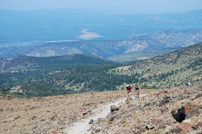
Soon beyond the falls is a large meadow that is often filled with wildflowers, but then the trail begins to climb. As it passes from the forest into more open terrain, wonderful views open up in several directions. Without shade, the second half of the hike can be hot on a summer afternoon. Hikers should carry plenty of water.
At 9,731 feet, hikers reach the saddle between Mount Houghton and Mount Rose. Then after following the ridge for a while, the trail begins a number of sweeping switchbacks across the rocky slope. Often it is quite windy as you approach the top. At last the summit arrives and views of all the surrounding area are spread before you.
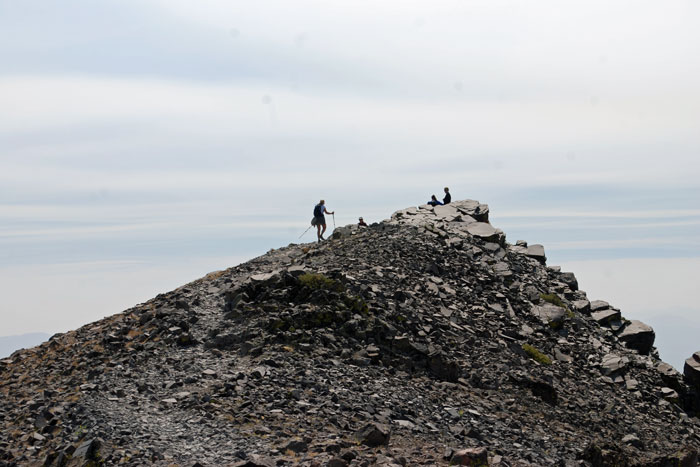
Summit of Mount Rose, 10,776 feet
Things to Know
- Be prepared for cooler temperatures and strong wind near the summit of the mountain.
- Leashed dogs are permitted on the trail.
- For those with water filters, the last reliable water source is around Galena Creek.
- Horses and bicycles are not allowed on the trail.
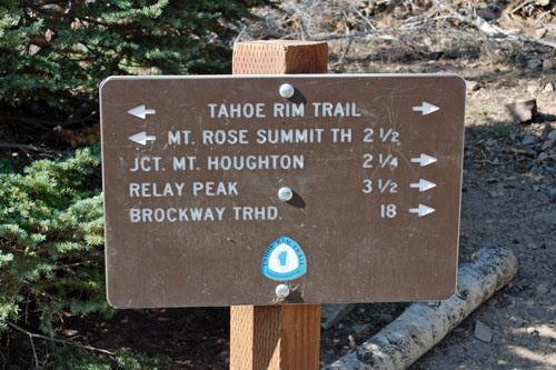
Sign at Saddle between Mount Houghton and Mount Rose
Nearby Sierra Day Hikes
- Cascade Falls - 1-mile hike to 200' falls
- Spooner Lake - an easy stroll around the lake
- Tahoe Meadows Interpretive Trail - Easy 1.3 mi.
- Van Sickle Trail - short loops with nice lake views
Other Nearby Trails
The Tahoe Rim Trail follows the Mount Rose trail from the parking lot to Galena Creek Falls. Beyond the falls, the Tahoe Rim Trail continues west to Relay Ridge and then south over Mount Houghton and onward around Lake Tahoe.
Explore the Wonders
Around Donner Summit
Hiking, Camping, Mountain Biking,
Road Cycling, Fishing, Boating