Mount Tallac Day Hike
South Lake Tahoe
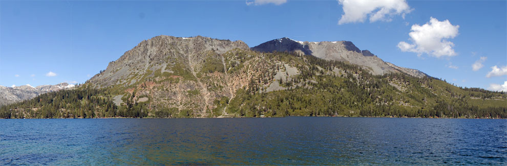
Mount Tallac (shown above on the right) rises from the west shore of Fallen Leaf Lake to an elevation of 9,738 feet. From its summit hikers have spectacular views of Fallen Leaf Lake, South Lake Tahoe, and the Desolation Wilderness. Despite the strenuous 5-mile, 3,380-foot climb, a steady flow of hikers sets out every summer morning on the Mount Tallac Trail. Some turn back part way, but most rejoice at the top.
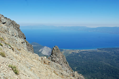
South Lake Tahoe from the Summit of Mt. Tallac
Mount Tallac Trailhead
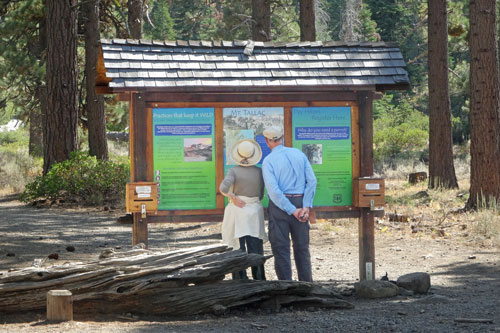
The Mount Tallac Trailhead is on Mount Tallac Road off Highway 89 between Camp Richardson and Emerald Bay. The parking lot fills early every summer day. There are no restrooms nor is drinking water available there. A free permit is required for day hikers to enter the Desolation Wilderness. They are available at a kiosk at the trailhead.
Mt. Tallac Trailhead
Mount Tallac Trail
Strenuous+
10 miles
3,380 feet
Lake Tahoe
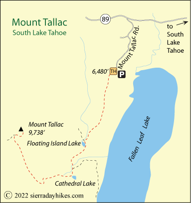
The most popular starting point is at the end of Mount Tallac Road off Highway 89 at an elevation of 6,480 feet. The trail climbs almost immediately up the spine of a ridge overlooking Fallen Leaf Lake. After 1½ miles the trail passes Floating Island Lake.
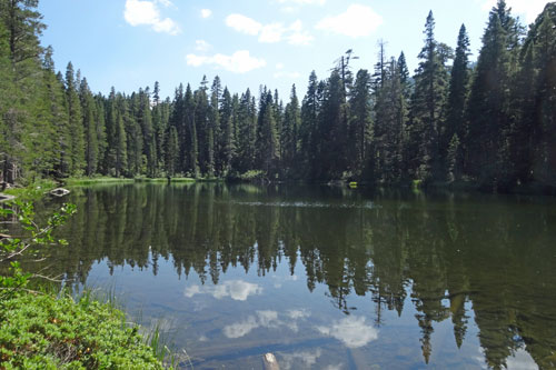
Floating Island Lake
Climbing steadily for another mile, hikers reach little Cathedral Lake, the last reliable water source on the hike. The next mile is the steepest of the climb, gaining about a thousand feet. When hikers finally arrive on the southern shoulder of Mount Tallac, only a little more than a mile remains to the summit - but still another thousand feet of climbing. Slow, steady walking leads to the top and a breathtaking panorama.
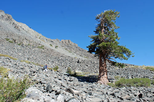
Mt. Tallac Trail
Hiking Suggestions
- Start early. With limited shade, this hike is more enjoyable in the cool of the morning.
- Carry plenty of water and a water filter so you can resupply along the way.
- Spend a couple of days at Lake Tahoe to acclimate to the elevation before attempting the climb.

Things to Know
- A free wilderness permit is required even for day hikes in the Desolation Wilderness. Find the forms at the trailhead kiosk.
- Restrooms are not available at the trailhead or along the hike.
- The trail is very rocky. Good footwear and hiking poles are recommended.
- Turn back if thunderstorms develop. The exposed ridges and summit of Mount Tallac are not safe during thunderstorms.
Nearby Sierra Day Hikes
- Cascade Falls - 1-mile hike to 200' falls
- Eagle Falls - a short walk to the Upper Falls
- Rubicon Trail - scenic shoreline hike, Bliss SP to Emerald Bay
Other Nearby Trails
From Taylor Creek Visitor Center, take the short Rainbow Trail, which includes the popular Stream Profile Chamber. Also follow the easy Lake of the Sky Trail down to a sandy beach on Lake Tahoe.