Four Mile Trail Day Hike
Yosemite National Park
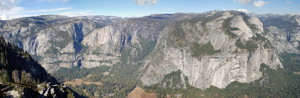
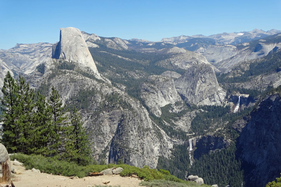
Four Mile Trail attracts hardy day hikers who are willing to tackle the strenuous climb from Yosemite Valley to Glacier Point. Once a 19th century toll road and once only 4 miles, Four Mile Trail now climbs 4.8 miles in a moderate grade the entire way to the top. Views of Yosemite Valley from Glacier Point (shown above) are magnificent.
Some hikers prefer to do the hike one-way, but there is no free shuttle between Glacier Point and the valley floor. The best solution is to have a friend pick you up. Another alternative is to make use of Tour Buses.
Four Mile Trail
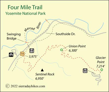
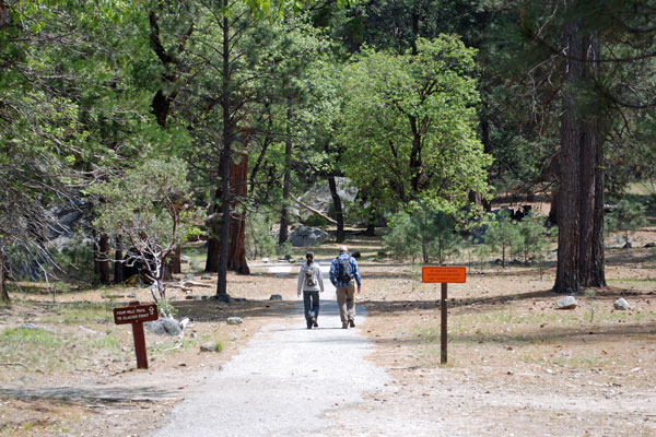
Four Mile Trail Trailhead
Strenuous
9.6 miles
3,200 feet
Yosemite
Four Mile Trailhead is along Southside Drive at the foot of Sentinel Rock. The nearest restrooms are near the Swinging Bridge. Bring plenty of water for your hike (at least 2 quarts per person for a one-way hike) since water is not available at the trailhead or along the trail. Water is available at Glacier Point from late May through October.
Four Mile Trail Trailhead
Four Mile Trail
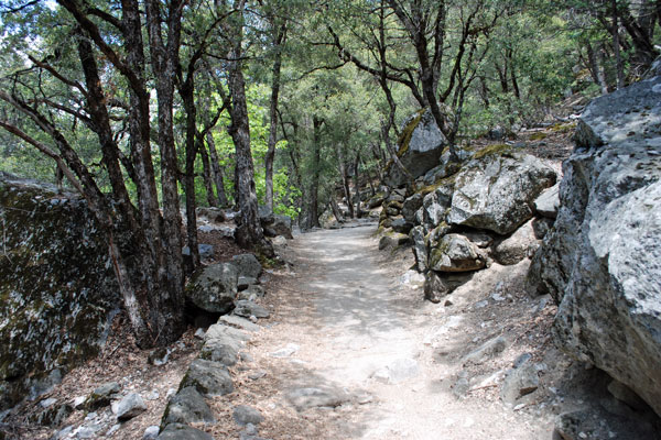
The Four Mile Trail climbs the north side of the valley, a much cooler route than trails on the south side. Begin the hike near the base of Sentinel Rock. During the early part of the hike, views are hidden by trees, but after a mile wonderful views begin to appear around every corner. Look back toward Cathedral Rocks and El Capitan. Gaze across at Yosemite Falls. Farther up enjoy views of Half Dome, Royal Arches, and Tenaya Canyon.
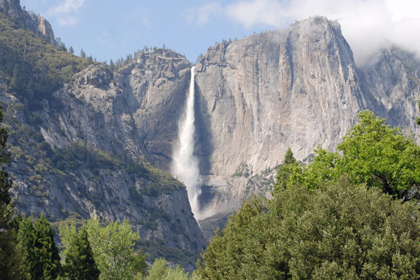
Yosemite Falls from Four Mile Trail
About two-thirds of the way up look for the side-trail to Union Point for nice views of Yosemite Valley. At the top the hike, of course, you have all of Glacier Point to enjoy. Buy snacks, refill water bottles, and use restrooms located around by the parking lots.
Four Mile Trail
Things to Know
- Pets, bicycles, and strollers are not permitted on the trail.
- Restrooms are available near Swinging Bridge in the valley and near the parking lot at Glacier Point.
- Drinking water is not available on the trail. The Park recommends that each hiker headed for Glacier Point carry 2 quarts.
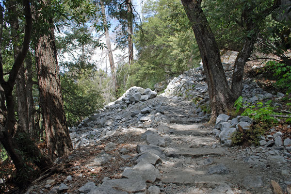
- Do not cut switchbacks.
- Be wary of your footing on paved sections of the trail with loose sand on the surface.
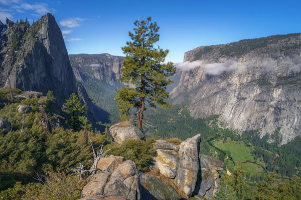
View from Four Mile Trail
Nearby Sierra Day Hikes
- Bridalveil Fall - short walk tothe base of beautiful waterfall
- Lower Yosemite Falls - easy walk on paved trails to the foot of falls
- Mirror Lake Loop - a 1-mile walk out to the lake
- Yosemite Falls Trail - a strenuous hike up to the top of Yosemite Falls
- Vernal Fall - hike to bridge or top of the fall
Other Nearby Trails
The Panorama Trail is an 8½ mile alternative for those headed back down to the valley from Glacier Point. Along the way it takes in Nevada and Vernal falls. With twice the mileage of the Four Mile Trail, Panorama Trail is best for those in very good shape.
Tour Buses
Tour Buses do run from the valley to Glacier Point. If you are only planning to hike down the trail, purchase your one-way ticket in the valley to guarantee yourself a seat going up. For those wanting a ride down from Glacier Point, you are taking your chances that an open seat will be available on a tour bus. You can't reserve those one-way seats going down. Purchase those tickets from the driver for cash if a seat is available.