Moro Rock Day Hike
Sequoia National Park
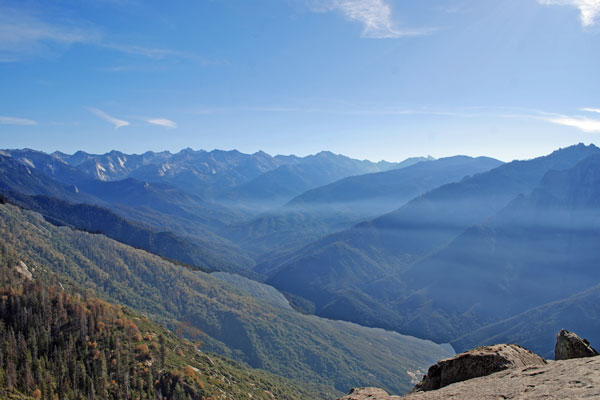
The short, but steep hike to the summit of Moro Rock rewards visitors with spectacular views of peaks along the Great Western Divide and the vast Kaweah River canyon below. Located near Crescent Meadow, south of Lodgepole Village, Moro Rock rivals the Sherman Tree as a popular destination in the park.
Moro Rock
Moro Rock Trailhead
Easy
½-mile
300 feet
Sequoia NP
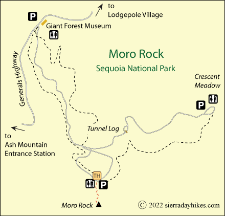
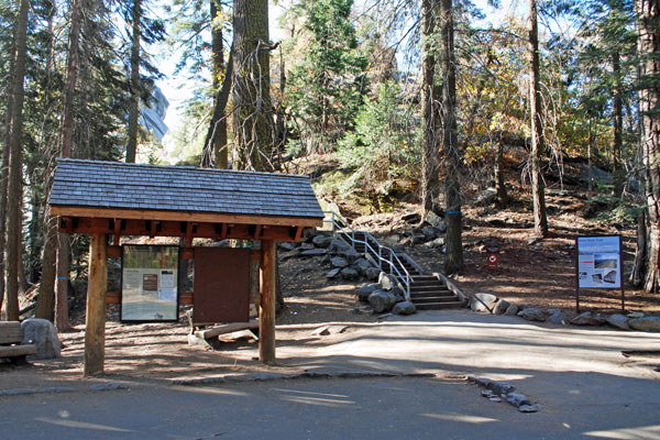
The Moro Rock Trailhead is south of the Giant Forest Museum. From the Generals Highway turn onto Crescent Meadow Road and then after 1½ miles onto the road to Moro Rock. A small parking lot is accompanied by restrooms and informational kiosks.
Summer Weekends at Moro Rock
On summer weekends the road to Moro Rock and Crescent Meadow is closed to private vehicles and visitors must use the free shuttle from the Giant Forest Museum to reach these points of interest.
Moro Rock Trailhead
Moro Rock Trail
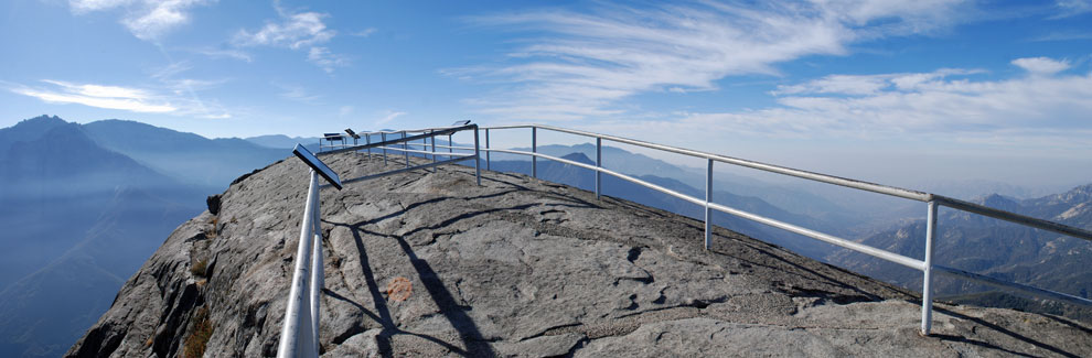
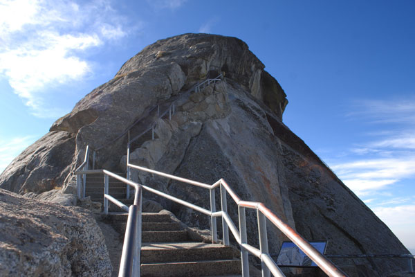
More than 350 concrete and stone steps lead up the side of the rock. A railing along the way protects hikers from precipitous tumbles down the face of the granite cliffs. Although it is a relatively safe ascent for adults and teenagers, younger children should be watched very closely. It is not recommended for small children. The rock stands 6,750 feet above sea level, but hikers only climb the last 300 feet. Nevertheless, plan to take numerous rest stops along the way to catch your breath and enjoy the view.
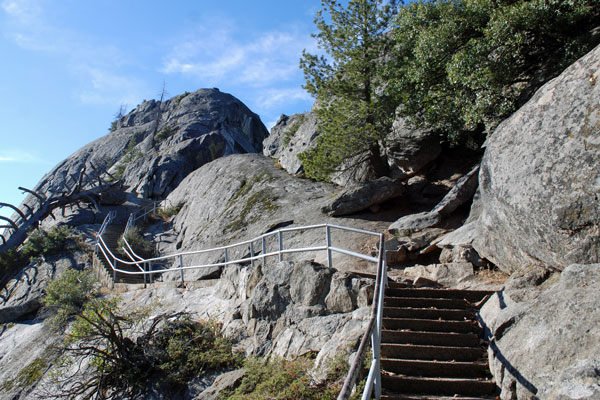
In places the trail narrows to single file. Viewpoints off the main trail are available in several spots offering views of the Middle Fork of the Kaweah River Canyon or peaks along the Sierra crest.
At the summit, visitors step out onto a rounded dome where they can take in the majesty of the surrounding terrain. Information panels provide the names of distant mountains such as Triple Divide Peak, Black Kaweah, Mount Stewart, and Mount Eisen. Below, the Generals Highway snakes up the mountainside from the distant Ash Mountain Entrance Station.
Great Western Divide
Things to Know
- It is unsafe to hike up Moro Rock during lightning storms or when snow or ice are on the trail.
- Pets are not allowed on any park trails.
- Restrooms are available at the trailhead.
- In the summer a free shuttle runs from Giant Forest Museum to Moro Rock.
Nearby Sierra Day Hikes
- Big Trees - enjoy an easy walk among Giant Sequoias on a paved trail at Round Meadow near Giant Forest Museum
- Crescent Meadow - walk among Sequoias to Tharp's Log House
- General Sherman Tree - hike down to the largest tree by volume in the world
- Tokopah Falls - a pleasant walk up the valley to the falls
Other Nearby Trails
The 1-mile Sugar Pine Trail connects Moro Rock with Crescent Meadow. The nearby Soldiers Trail leads 0.1 miles to the Roosevelt Tree and another 2.3 miles to the Giant Forest Museum.