General Creek Day Hike
Sugar Pine Point State Park
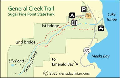
General Creek Trail in Sugar Pine State Park leads up General Creek through a pleasant forest of sugar pines and Jeffrey pines and through meadows sprinkled with wildflowers. The gurgle of General Creek is occasionally nearby. With two possible trailheads and two bridges along the way to form loops, hikers can choose from a variety of combinations of routes, making a 3-mile loop, a 4-mile loop, or something longer.
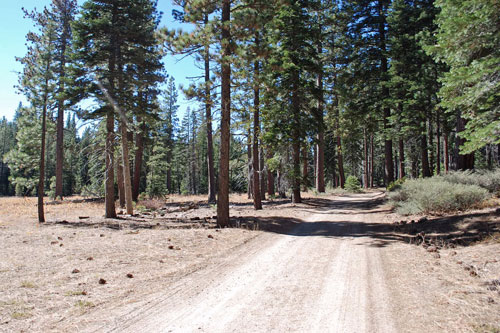
General Creek Trail
General Creek Trailhead
The General Creek Trail has several possible trailheads within Sugar Pine Point State Park. Campers at the park can simply walk west on the main campground trail and pick up the General Creek Trail between campsites 47 and 49. Others may choose to start from the campfire circle near the eastern entrance gate and follow the same trails. Day parking is allowed in the area designated as the campground entrance.
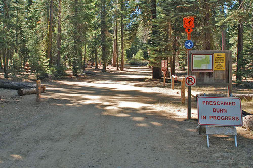
General Creek Trailhead
A third option is from the picnic area on the eastern side of Highway 99 south of the campground entrance gate. Wherever hikers start, the loops can be done in whatever order is chosen. The entrance fee for the park is $10 for day use.
General Creek Trail
Easy
4 miles
320 feet
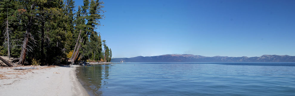
Lake Tahoe
Begin hiking from the campfire center and follow the main trail west through the campground, picking up the General Creek Trail between campsites 147 and 148. For the first two miles on the north side of General Creek the route is wide and smooth. This section of trail was used nor Nordic events in the 1960 Squaw Valley Olympics.
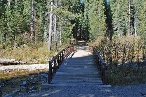
First Bridge on General Creek Trail
Crossing the creek at the first bridge (about mile 1) leads hikers back on the south side of the creek to the picnic area and looping north either on the bike trail by the highway or on trails through the park near the shore.
An alternative is to continue along the trail on the north side of the creek for another mile and cross at the second bridge. Then heading back along the south side of the creek gives hikers the option of crossing back at bridge #1 and returning to the trailhead or staying on the south side all the way to the picnic area. Others may want to continue on up the creek's north side, even as far as Lily Pond, 3 miles from the campfire circle trailhead.
Things to Know
- Leashed dogs are allowed on the General Creek Fire Road when it is not maintained as a ski trail. Check with park rangers for details.
- Water and restrooms are available in the campgrounds or picnic areas.
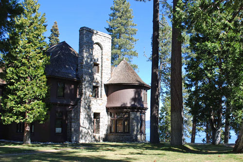
Pine Lodge, Sugar Pine Point State Park
Nearby Sierra Day Hikes
- Cascade Falls - 1-mile hike to 200' falls
- Eagle Falls - hike to upper falls and Eagle Lake
- Mount Tallac - strenuous hike to summit for wonderful views
- Rubicon Trail - s scenic hike along the shore of Lake Tahoe from D. L. Bliss State Park to Emerald Bay.
- Van Sickle Trail - short loops with nice lake views
Other Nearby Trails
The Dolder Nature Trail leads off the Rod Beaudry Trail which starts at the Nature Center. The 1½-mile loop of the paved Dolder Nature Trail circles the Edwin L. Z'Berg Natural Preserve.