Shirley Lake Day Hike
Palisades Tahoe
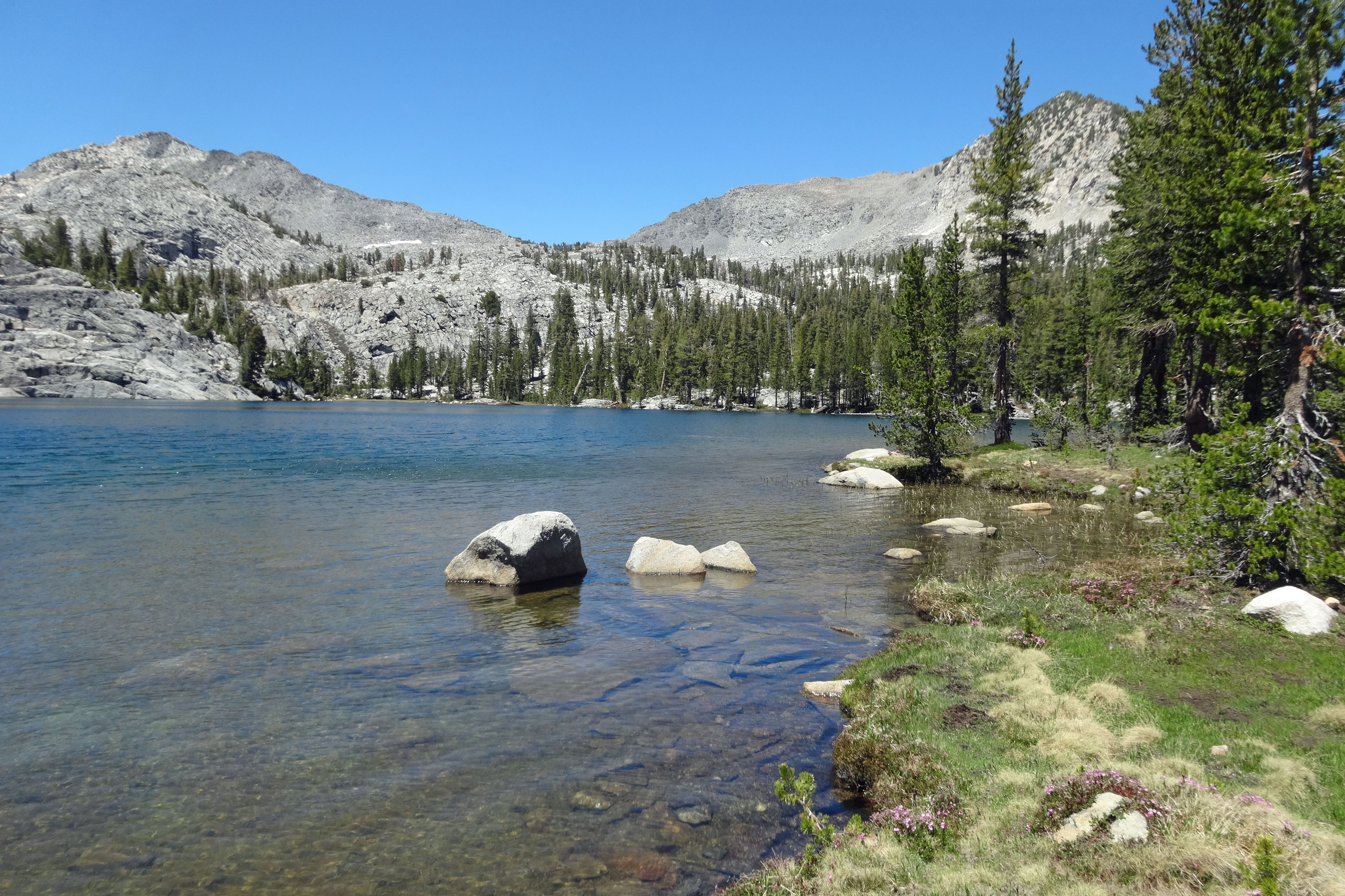
The 2½-mile hike from Palisades Tahoe up to Shirley Lake challenges hikers with several steep, rocky chutes which can hardly be called trail and some minor route-finding challenges near the top. The rewards include a number of scenic waterfalls and cataracts along the trail and wonderful, ever-changing views of Palisades Tahoe and surrounding peaks.
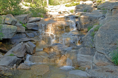
One of Several Small Cascades along the Trail
Shirley Lake Trailhead
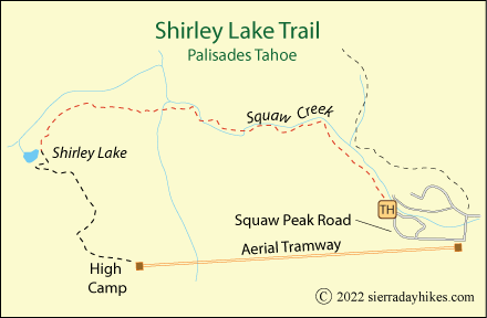
The main Shirley Lake trailhead is found at the northwestern-most bend of Squaw Peak Road (a one-way loop) at an elevation of 6,250 feet. A trailhead sign describes the hike. Parking is available on the side of the road, but if all the spots are taken, park back at the Village at Squaw Valley. Restrooms, water, and food are available in the Village.
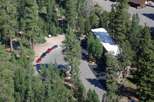
Shirley Lake Trailhead
Shirley Lake Trail
Strenuous
3¾ miles
1,885 feet
Lake Tahoe
The 1,300-foot ascent to the lake begins as a well-maintained forest path, but about half way up the trail deteriorates in many places into steep, rocky scrambles. Hiking poles are strongly recommended.
For most of the hike the trail follows on the left side a Squaw Creek, starting out with a moderate grade through the forest. Much of the route is well marked with signs, posts, and stripes painted on rocks (not exactly environmentally correct). Those wanting just a short hike can make their way to a couple of the waterfalls and then double back. Hikers intent on reaching Shirley Lake should expect some rugged terrain soon after the first mile.
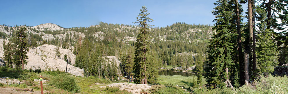
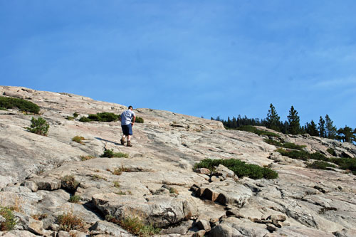
On the upper part of the trail, hikers have to scramble over boulders, negotiate steep chutes, and work their way up slabs of glaciated granite. At times the trail can be hard to follow, especially if there is any snow still on the ground. A GPS or an app such as Gaia GPS on your phone can be useful in pointing the right direction. Shirley Lake is far from the most scenic destination in the Sierra, but is worth visiting.
Trail to Shirley Lake
Rather than backtrack down treacherous terrain, prudent hikers continue on another 1¼ miles and 550 feet from the lake up to Palisade Tahoe's Aerial Tram at High Camp and take advantage of the free ride down. The views from the tram are well worth the extra mile. The trail from Shirley Lake leads up in a south-southeasterly direction to High Camp. Some trail junctions are marked, others are not. When in doubt, continue uphill. Check with Aerial Tram Rides for hours of operation and current conditions.
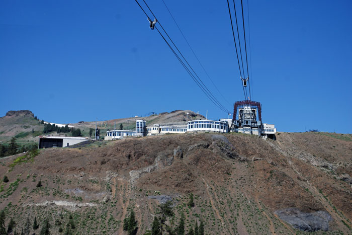
Aerial Tram from High Camp
Things to Know
- Dogs are permitted on the Shirley Lake Trail as well as the aerial tram (except during ski season).
- Water, restrooms, and overflow parking are available in the Village.
- Bring a wilderness water filter so you can resupply along the way.
- Hiking poles are highly recommended for this route.
Nearby Sierra Day Hikes
- Cascade Falls - 1-mile hike to 200' falls
- Eagle Falls - hike to upper falls and Eagle Lake
- General Creek - Sugar Pine Point State Park
- Mount Tallac - strenuous hike to summit for wonderful views
Other Nearby Trails
The Squaw Creek Trail ascends 3 miles to Mountain Meadow Lake. Another 4 miles completes an arduous loop over the shoulder of Granite Chief and returns to the tram at High Camp.